BioMIS
Biodiversity IntelligenceOne Platform. One Ecosystem. One Future.
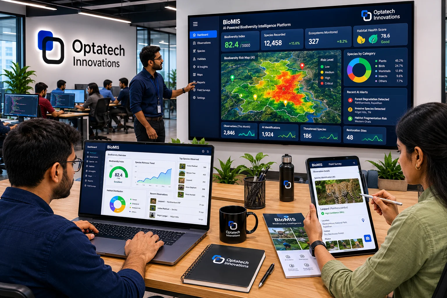
BIOMIS is an AI-powered Biodiversity Intelligence & Monitoring Information System — creating a unified digital ecosystem for biodiversity conservation, forest and wildlife monitoring, climate resilience, natural resource management, and evidence-based environmental governance at state scale.
SERVICES:
TECH STACK:
Impact That Proves
Intelligence Layers
Monitoring Systems
SDG Alignment
Ecosystem Registry
The Challenge
Biodiversity and ecosystem management across India suffers from fragmented data, reactive governance, and almost no predictive capability — leaving governments unable to detect habitat loss, wildlife decline, or climate threats until the damage is already done.
- Biodiversity records are fragmented across departments, manually collected, and inconsistently standardized with no central source of truth.
- Forest degradation, habitat fragmentation, and invasive species spread are detected only after significant loss has occurred.
- Wildlife monitoring relies on periodic census operations rather than continuous, AI-powered surveillance.
- Water resources, wetland health, and aquatic biodiversity are tracked in isolation from forest and climate data.
- Policymakers lack simulation and decision support tools — governance is reactive, not predictive.
The result is environmental governance that is perpetually behind the curve. BIOMIS was built to create a single, continuous, AI-powered intelligence network across every layer of the ecosystem.
Impact We Made
BIOMIS transforms biodiversity data from a static archive into a live intelligence ecosystem — enabling continuous monitoring, predictive conservation, and evidence-based governance across seven integrated intelligence layers.
- Digital Biodiversity Register unifying species, flora, fauna, habitat, and ecosystem records across state and district levels.
- AI-powered forest monitoring via satellite and drone — detecting degradation, tracking regeneration, and assessing fire risk in near real-time.
- Wildlife intelligence platform with species recognition, camera trap analytics, corridor identification, and human-wildlife conflict hotspot mapping.
- Water intelligence layer monitoring river health, wetland status, watershed performance, and aquatic biodiversity.
- Governance dashboard suite from state to Gram Panchayat level — with SDG tracking, compliance alerts, and biodiversity scorecards.
Our approach — engineered for clarity
BIOMIS is structured around seven interconnected intelligence layers, each contributing to a statewide Environmental Digital Twin — the first unified ecosystem intelligence framework connecting biodiversity, forests, wildlife, water, climate, and governance into one platform.
Biodiversity, Forest & Wildlife Intelligence
- Digital Biodiversity Register with species, habitat, ecosystem, and conservation area registries continuously updated from field and remote sources.
- Satellite, drone, and AI-based forest monitoring tracking canopy density, health scores, regeneration success, and degradation detection.
- Wildlife platform with CNN/AI-based species recognition, camera trap analysis, animal movement monitoring, and corridor health indicators.
- Freshwater intelligence monitoring river health, wetland conservation status, watershed performance, and aquatic species distribution.
Deliverable: Unified Digital Biodiversity Register with forest, wildlife, and water intelligence dashboards.
Climate, Ecosystem Services & Governance Intelligence
- Climate intelligence layer assessing carbon stock, sequestration, drought risk, climate vulnerability, and ecosystem resilience scores.
- Ecosystem services valuation quantifying carbon sequestration, water regulation, pollination, soil conservation, and natural capital worth.
- Community intelligence platform integrating citizen science, participatory monitoring, and local knowledge into the governance framework.
- Multi-level governance dashboards from state to Gram Panchayat with SDG monitoring, sustainability reports, and policy performance metrics.
Deliverable: Governance intelligence suite with climate MRV, ecosystem service valuation, and SDG compliance tracking.
What we shipped (features)
- Digital Biodiversity Register — Centralized, continuously updated registry of species, habitats, ecosystems, and conservation areas across state boundaries.
- Forest Intelligence Platform — Satellite and drone-based forest cover mapping, canopy density assessment, degradation detection, and fire risk forecasting.
- Wildlife Intelligence System — AI species recognition, camera trap analytics, corridor identification, animal movement monitoring, and human-wildlife conflict hotspot mapping.
- Water & Wetland Intelligence — River health monitoring, wetland conservation status, watershed performance scoring, and aquatic biodiversity tracking.
- Climate & Carbon Intelligence — Carbon stock and sequestration monitoring, drought risk prediction, climate vulnerability mapping, and net-zero planning support.
- Ecosystem Services Valuation — Natural capital accounting — quantifying and valuing carbon, water regulation, pollination, soil conservation, and eco-tourism potential.
- Community Intelligence Platform — Citizen science app, participatory monitoring, local knowledge integration, and human-wildlife conflict reporting.
- Governance Intelligence Dashboards — State to Gram Panchayat dashboards with biodiversity scorecards, SDG tracking (6, 13, 14, 15), and environmental compliance alerts.